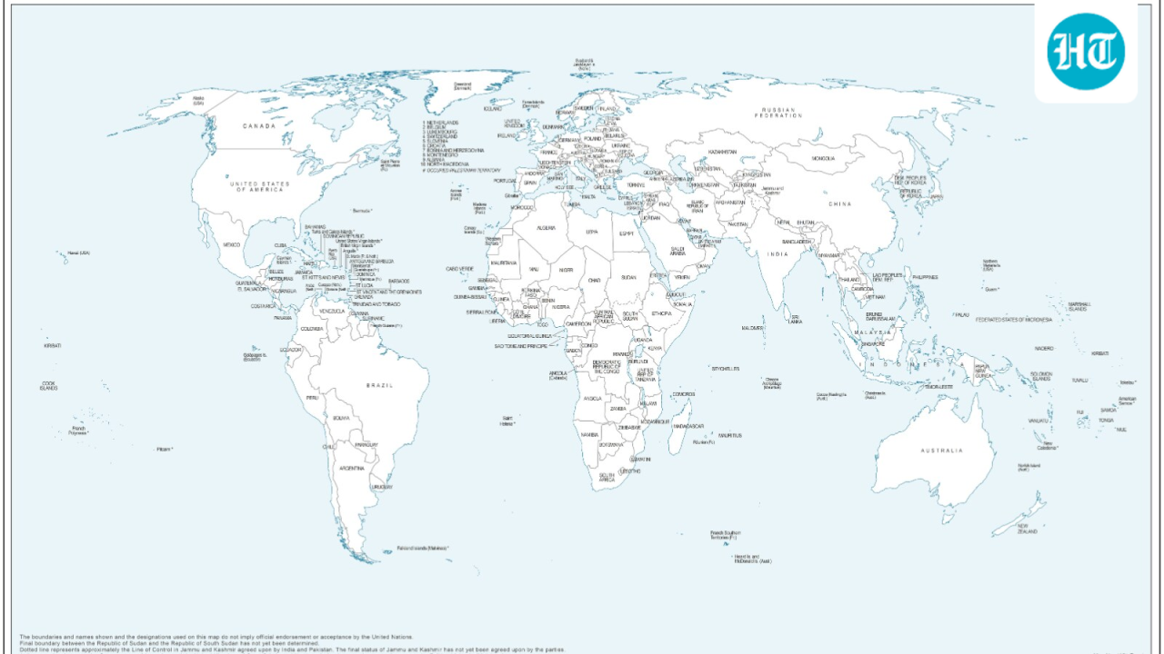

UN’s New Map Shows Arunachal and Aksai Chin Separately
Indiadailyupdate.com – UN’s new map shows two long-disputed territories — Arunachal Pradesh and the Aksai Chin plateau — rendered as standalone regions sandwiched between India’s and China’s dashed claim lines. India’s Ministry of External Affairs moved quickly to clarify that New Delhi’s earlier affirmative vote on a UN General Assembly resolution concerning cartographic fairness was never an endorsement of any particular map product.
The chart first surfaced on July 1, while member states were still negotiating the language of what would become the “Correct the Map” resolution. In its depiction of northeastern India, the UN’s new map shows Arunachal Pradesh severed from Nagaland, presented as an isolated entity bordered by Assam to the west and Chinese-administered land to the east. Aksai Chin, a high-altitude plateau India treats as part of the Union Territory of Ladakh, likewise receives its own separate designation. The UN has published no explanation for these cartographic choices.
India’s Vote and the Equal-Area Principle
On September 4, the General Assembly adopted an African Union-backed resolution titled “Correct the Map,” urging more accurate and equitable geographic representation on world maps, with particular attention to African nations whose sizes have historically been distorted by common projection methods. India voted in favour. The resolution’s core technical concern is the adoption of equal-area projections — map projections that preserve the relative surface areas of landmasses rather than inflating them, as Mercator-style projections do.
At a press briefing, MEA spokesperson Randhir Jaiswal clarified that India’s affirmative vote rested solely on the mathematical principle behind equal-area cartography, not on any approval of a specific map produced by a private entity or intergovernmental body. He stressed that the UN’s new map shows a projection choice, not a sovereignty determination.
“We favoured the resolution and voted in favour of the resolution. When the resolution was adopted in the UN General Assembly, we also made a statement where we clarified our position. The resolution is focused on the principle of equal-area maps. It does not endorse any map of any private party or any particular entity.”
Sovereignty Position and the Line of Control
Separately from the India-China question, the map marks the Line of Control in Jammu and Kashmir with a dotted line separating Indian- and Pakistani-administered areas. An annotation on the chart’s left margin reads:
“The dotted line represents approximately the Line of Control in Jammu and Kashmir agreed upon by India and Pakistan. The final status of Jammu and Kashmir has not yet been agreed upon by the parties.”
This language mirrors the longstanding diplomatic formulation used in UN documents since the 1948 partition of the princely state and does not constitute a sovereignty determination by the UN Secretariat. Jaiswal stated that India’s sovereign territory, including the Union Territories of Jammu and Kashmir and Ladakh, must appear in strict accordance with India’s official maps, and that any inaccurate or misleading depiction is unacceptable.
The ministry further noted that the Equal Earth projection — the specific projection referenced in the resolution’s implementation discussions — should not be permitted to alter how existing national borders are rendered. The geometric properties of a projection, the MEA emphasised, are separable from the political question of which boundaries are drawn and how they are labelled. The UN’s new map shows, in the ministry’s view, a technical rendering choice that must not override established territorial positions.
FAQ
Why did India vote for the “Correct the Map” resolution if it objects to the map? India’s vote supported the mathematical principle of equal-area projections, not any specific cartographic product. The MEA clarified that endorsing a projection method is distinct from endorsing how